

Clomantagh Hill [Killoshulan] [Cnoc na Cloiche Mantai]
Good walks are even better shared.
Overview
Clomantagh Hill [Killoshulan] [Cnoc na Cloiche Mantai]
Clomantagh Hill, sitting at a proud elevation of 650 meters, is an enchanting spot nestled in Kilkenny, Ireland. Not only does it offer stunning vistas and a modest hiking challenge, but the hill is an explorer's delight with its fascinating geology and rich history.
Geological Highlights
The hill is predominantly limestone and sandstone, hosting various geological formations, inviting both geology enthusiasts and curious hikers alike. For those who find beauty in rocks, Clomantagh is like a polished diamond in a rural setting.
Hiking Routes
One of the most popular trails is the Clomantagh Hill Loop Trail, a circular route of about 6.5 kilometres, which provides an excellent balance of challenge and scenic rewards. Expect a moderate hike that can naturally lead to some impressive views of the landscapes around.
Summit Features
Reach the summit, and you’ll be greeted by a lovely stone cairn that stands tall and proud. It’s a popular photo spot for hikers resting from the ascent—perfect for your social media bragging rights!
Terrain and Views
Expect a delightful combination of grassy slopes and rugged paths. The views from the summit are a revelation, with sights extending to the Slieve Bloom Mountains and beyond. Spring and autumn are ideal times to visit, when the weather cooperates for amazing panorama shots and the landscape is rich in colour.
Hazards and Safety
While Clomantagh rewards you with beauty, do watch your step; some paths can be boggy, and a good pair of boots will serve you well. Remember, the only thing worse than a muddy boot is an injured ankle.
Access and Facilities
Accessing Clomantagh Hill involves a short drive to a local parking area. There’s a small café in Castlecomer where you can refuel after your adventure—because hiking on an empty stomach is a rookie mistake!
History
The hill's name translates to 'the hill of the rocks' in Gaelic—a fitting title indeed. With its links to ancient folklore and tales of settlers, every step up Clomantagh feels like a stroll through history.
So pack your backpack, grab some friends, and head to Clomantagh Hill for a day of adventure, scenic wonders, and perhaps a newfound appreciation for geology.
Explore routes near Clomantagh Hill [Killoshulan] [Cnoc na Cloiche Mantai]
Public walks starting within 80 km of this hill. Nearby does not mean a route reaches the summit; check its map and access before setting out.
No public routes are currently listed within 80 km of Clomantagh Hill [Killoshulan] [Cnoc na Cloiche Mantai] on Walkmates. This does not mean there are no paths here. Explore the map and check local access information before planning a walk.
Route planning notes
These notes describe possible approaches, not verified navigable routes or permission to cross land. Check current paths, local access rules and conditions before setting out.
Clomantagh Hill Loop Trail
A circular route starting from the base, providing a gentle ascent and stunning views of the surrounding hills and valleys.
Make a day of it, together
Find someone to share the walk with, or organise a day out along a route you like.
Photo Gallery
View all Photo could not load
S3365 : Summit Cairn
kevin higgins
Hill facts and local notes
Classifications
Elevation
349m
1,145 ft
Prominence
224m
Coordinates
52.7399, -7.5092
S332655
OS Map
60
At the Summit
At the top, you will be greeted by a beautiful stone cairn, proudly standing as a marker and offering plenty of photo opportunities for those seeking a trophy shot.
Terrain & Geology
Predominantly composed of limestone and sandstone, Clomantagh Hill's unique geological features include interesting rock formations and rich fossil deposits. The hill’s diverse geology makes it an inviting spot for geology enthusiasts and those who enjoy combing through history written in stone.
Views & Scenery
On a clear day, watch out for views stretching as far as the Slieve Bloom Mountains to the north and the unspoiled valleys below. You might even spot an eagle or two auditioning for their own nature documentary.
History & Heritage
Name Origin
The name 'Clomantagh' is derived from Gaelic, meaning 'the hill of the rocks', fitting given its rocky terrain.
Historical Significance
This area is rich in local folklore, often associated with stories of ancient settlers and mythical creatures said to roam these hills.
Getting There & Facilities
Check current local access restrictions, parking rules and transport timetables before travelling. These notes do not confirm public access to the summit.
Parking
There is a small parking area off the local road leading to the hill, just outside the village of Balleen. It's not the Ritz, but it gets the job done.
Public Transport
Limited public transport options are available, with infrequent bus services from Kilkenny City to the nearby village. Carpooling is highly recommended.
Nearby Facilities
You won't find much up on the hill, so it's best to pack your own snacks and sandwiches! The nearest café for a post-hike treat is in Castlecomer.
Safety Information
Known Hazards
- Some areas may be boggy after rainfall, and as always, watch your step on the rocky path—this mountain doesn't play nice with twisted ankles!
General Safety Tips
- Check weather conditions before setting out
- Carry appropriate clothing and equipment
- Let someone know your planned route
- Take a map, compass, and GPS device
- Carry emergency supplies: food, water, first aid kit, torch
Hills
Some common questions about the hills answered
Are there group walks up Clomantagh Hill [Killoshulan] [Cnoc na Cloiche Mantai]?
Many walkers use Walkmates to join or organise walks with others. You can check for group walks around Clomantagh Hill [Killoshulan] [Cnoc na Cloiche Mantai] through the maps
Are there other walkers around Clomantagh Hill [Killoshulan] [Cnoc na Cloiche Mantai]?
Activity varies by location and time, but Walkmates lets you see whether others have shared walks or shown interest in this area. Find other people through the walking friends search walking friends for Clomantagh Hill [Killoshulan] [Cnoc na Cloiche Mantai] search or of course create your own walk for Clomantagh Hill [Killoshulan] [Cnoc na Cloiche Mantai]
Can I organise a walk to Clomantagh Hill [Killoshulan] [Cnoc na Cloiche Mantai]?
Yes. If there aren’t any walks listed already, you can create a walk and make it available for others to join.
If you're signed up to Walkmates, you can create a walk to Clomantagh Hill [Killoshulan] [Cnoc na Cloiche Mantai].
How do I find a walk up this hill?
There are often multiple ways to walk this hill, depending on experience and route preference. Walkmates helps you explore walks and routes that others have shared.
Can I suggest a new route up Clomantagh Hill [Killoshulan] [Cnoc na Cloiche Mantai]?
Yes. You can suggest or create routes to share with others. Walkmates focuses on the social side of walking, so routes are used to help people organise walks and explore areas together, rather than as detailed navigation tools or route libraries.
Other uses really appreciate knowledgeable walkers sharing their routes. Share your favourite route to Clomantagh Hill [Killoshulan] [Cnoc na Cloiche Mantai] here
The is an error or something incorrect about this hill. How do I let you know?
We always strive to keep the information on Walkmates as accurate as possible. If you find an error, please let us know through the contact form and we'll aim to correct it as quickly as possible
Community Discussion
Comments
Location
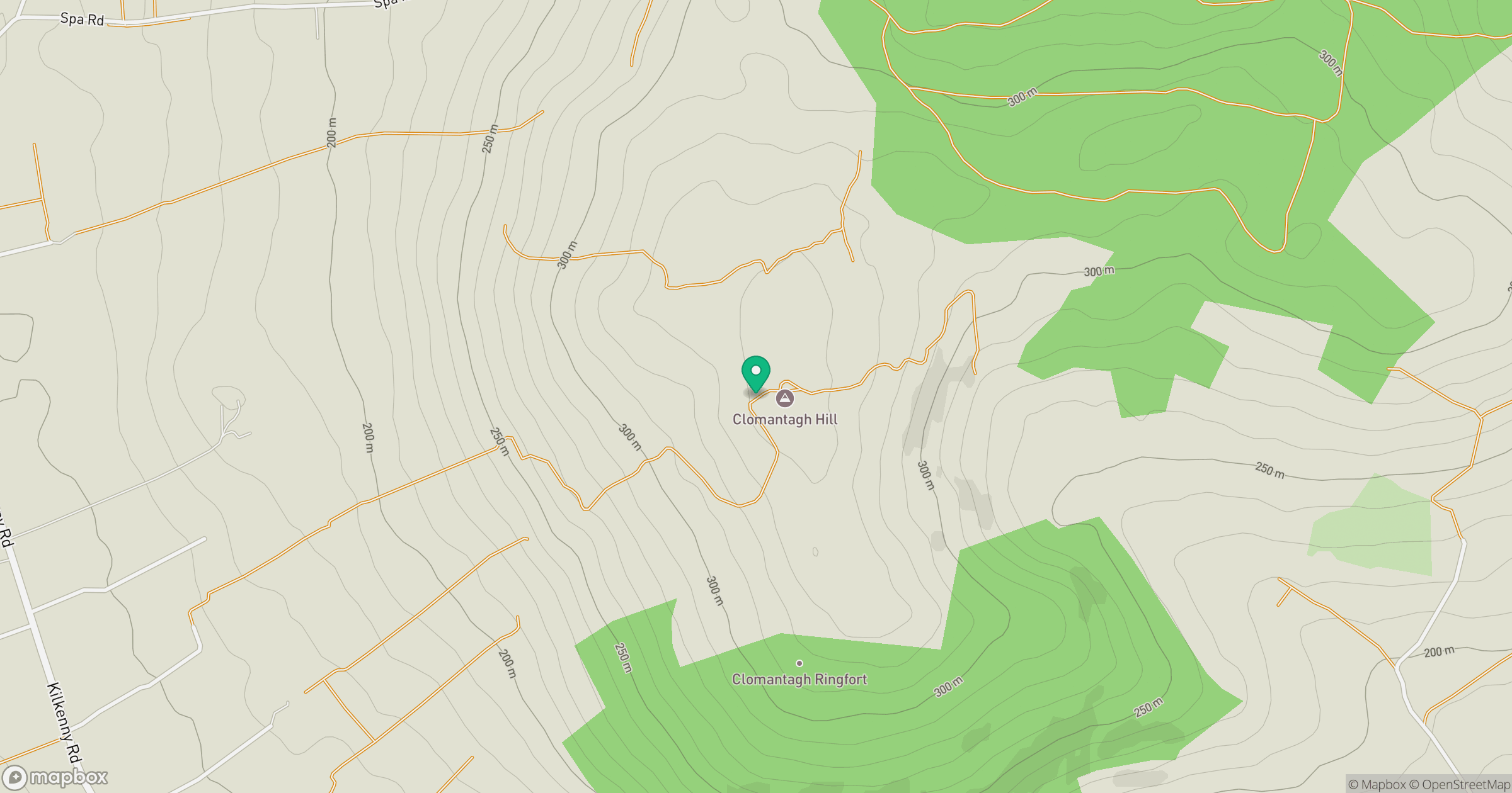
Grid reference: S332655
View on OpenStreetMapOpens a map in a new tab, centred on the hill.
Hills within 30 km
Straight-line distance, not a walking route or confirmation of access.
Devilsbit Mountain [Bearnan Eile]
480m
Knockmannon Hill
313m
Knocknamuck [Cnoc na Muc]
340m
Black Hill
228m
Cullenagh Mountain [Sliabh Chuileannai]
317m
No comments yet. Be the first.